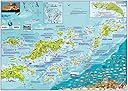
British Virgin Islands BVI Laminated Wall Map
Product ID: 47201731
Desertcart purchases this item on your behalf and handles shipping, customs, and support to Austria.
Detailed Maps for Diving, Snorkeling & Other Activities - Colorful with Beautiful Shaded Relief Laminated - 18.5" x 26" Loaded with information for everything there is to see and do. The colorful maps have shaded relief on land masses and hues of blue to denote water depths. Side One highlights Jost Van Dyke, Tortola and Virgin Gorda. Inset map of Anegada and detailed illustration of the RMS Rhone wreck. There are colorful illustrations of BVI coral reef creatures. Side Two covers the entire BVI island group. Inset map of Road Town, Tortola. Dive and snorkel sites are located, named, and described with detailed text. Guide text includes dive operators, charter boats, island facts and more. 18.5" x 26". Laminated with edge seal. Ships rolled. Makes a great poster, placemat or handy reference. For the folded, waterproof edition of this map, please search 1601909748 on desertcart. Review: Great for planning and documenting your trip - I got this map to use as my personal planner and to document where we sailed and moored our chartered catamaran as it is not an official chart. But the entire crew of 6 experienced captains used it almost daily as well as it was a good view of the entire BVIs instead of the smaller views in the guides or chart plotter. Be aware that the oil on hands will take off even permanent markers. I had to re-do my map after we got back! Review: Great map, handy on charters! - This was a fantastic map for to plan our BVI's charter! Not a true navigational chart, but the BVI's are easy cruising, and a real chart is barely necessary. A perfectly good map, and the kids loved identifying the fish we saw. The laminating was heavy duty and well done, should last some abuse. We actually rolled ours and stuffed it with clothes for plane trip.
| Best Sellers Rank | #193,267 in Books ( See Top 100 in Books ) #5 in Virgin Islands Travel Guides |
| Customer Reviews | 4.8 out of 5 stars 71 Reviews |
N**K
Great for planning and documenting your trip
I got this map to use as my personal planner and to document where we sailed and moored our chartered catamaran as it is not an official chart. But the entire crew of 6 experienced captains used it almost daily as well as it was a good view of the entire BVIs instead of the smaller views in the guides or chart plotter. Be aware that the oil on hands will take off even permanent markers. I had to re-do my map after we got back!
B**R
Great map, handy on charters!
This was a fantastic map for to plan our BVI's charter! Not a true navigational chart, but the BVI's are easy cruising, and a real chart is barely necessary. A perfectly good map, and the kids loved identifying the fish we saw. The laminating was heavy duty and well done, should last some abuse. We actually rolled ours and stuffed it with clothes for plane trip.
D**.
great map
We took this along on our trip. Was a great reference for everyone on the boat.
C**T
Detailed map
Used this map to sail in the BVI's. Very detailed and helpful for sailors/travelers. Durable and easy to transport.
D**B
Perfect for upcoming SCUBA trip to the BVI
Perfect solution to an upcoming dive trip to the BVI. I did many searches online for dive sites but each search only listed some of the options. I found myself printing pages and pages of information and entering them into Excel in order to standardize the information. This map includes all of the site options I found plus more. Add diving depth, suggested skill level, site description as well as dive shop locations and this is pretty much a one stop shopping guide to choosing your dive locations and planning the dive. Can't wait to put it to use!
D**.
Great map
Bought before our BVI trip and was best map . Really nice to lay out and look over where you want to go next
D**S
Great resource for diving in BVI's
We bought this before a trip to the BVI's. We had our scuba gear and this map was really helpful for us to know where to dive and other areas of interest.
E**Z
It’s water proof and fun to look at between cruises.
The map is a quick and easy reference to each island’s opportunities.
Trustpilot
3 days ago
3 weeks ago